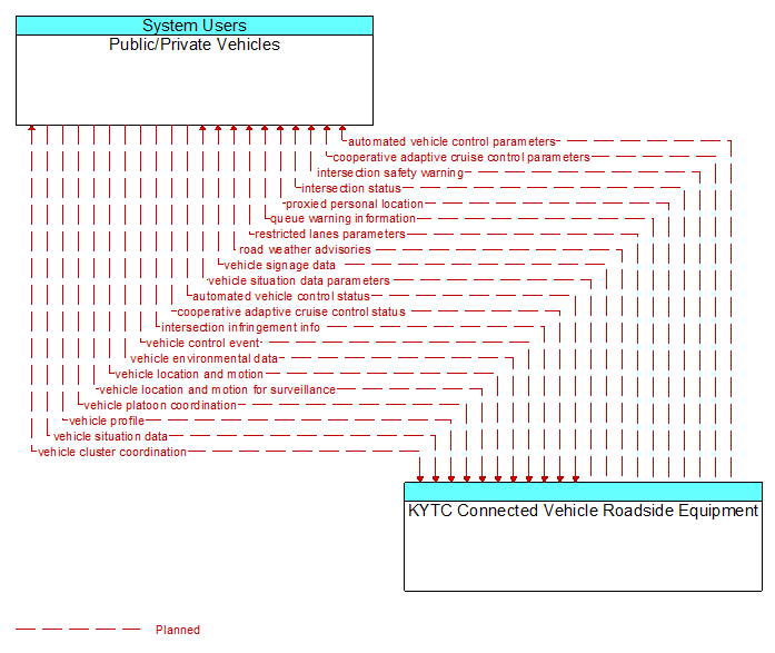
Interface: Public/Private Vehicles - KYTC Connected Vehicle Roadside Equipment
Information Flow Definitions
automated vehicle control parameters (Planned)
Information, instructions, and control parameters for automated vehicle operations including current system conditions and advisories, control parameters (e.g., speed, required vehicle performance profiles, gaps or headways) and check in/checkout instructions.
automated vehicle control status (Planned)
Data provided by a connected vehicle identifying it's current mode and operational status and information provided to support check–in/checkout of the lane and coordinated maneuvers while on the automated facility.
cooperative adaptive cruise control parameters (Planned)
Information, instructions, and control parameters for CACC operations including current system conditions and advisories, control parameters (e.g., target speeds, required vehicle profiles, recommended gaps, lane information) and cluster instructions that support CACC vehicle string creation and dissolution.
cooperative adaptive cruise control status (Planned)
Data provided by a connected vehicle identifying it's current mode and operational status and information provided to support CACC string creation and dissolution.
intersection infringement info (Planned)
Vehicle path information sent by a vehicle that is violating the stop bar at an intersection. This flow includes the vehicle's position, heading, speed, acceleration, transmission, steering–wheel angle, braking status, size information and trajectory.
intersection safety warning (Planned)
A warning of an imminent unsafe vehicle infringement at an intersection that may endanger other vehicles or pedestrians. This allows vehicles approaching the intersection to be warned in the event of an imminent red light or stop sign violation or potential infringement on an occupied crosswalk. All connected vehicles at the intersection receive the warning, including both the infringing vehicle and other vehicles at or near the intersection.
intersection status (Planned)
Current signal phase and timing information for all lanes at a signalized intersection. This flow identifies active lanes and lanes that are being stopped and specifies the length of time that the current state will persist for each lane. It also identifies signal priority and preemption status and pedestrian crossing status information where applicable.
proxied personal location (Planned)
Relay of pedestrian, bicyclist, and other non–motorized user locations at an intersection. This relay or rebroadcast of personal locations supports coordination between motorized and non–motorized users that do not have interoperable communications capability.
queue warning information (Planned)
Information regarding formed or impending queues (location of the end of queue, estimated duration of the queue, and other descriptions of the queue condition) and recommendations for upstream vehicles including speed reduction, lane change, or diversion recommendations.
restricted lanes parameters (Planned)
The location, duration, and operating parameters for lanes that are reserved for the exclusive use of certain types of vehicles (e.g., transit vehicles) or vehicles that meet other qualifications (e.g., number of occupants, low emissions criteria). It identifies the lane(s), the start and stop locations, start and end times, vehicle restrictions, speed limits and platooning parameters.
road weather advisories (Planned)
Segment–specific weather and road conditions including real–time advisories of deteriorating road and weather conditions, medium–term advisories for the next 2�12 hours, and long–term advisories more than 12 hours into the future. The advisories may include advisories that are issued by the RSE based on locally collected environmental data (e.g., an ice on bridge advisory).
vehicle cluster coordination (Planned)
Coordination between CACC–equipped vehicles that enable formation and management of strings of adjacent equipped vehicles that coordinate speed management across the string. This flow includes coordination between CACC–equipped vehicles that enable adjacent vehicles in the same lane to identify each other and couple. Depending on the CACC implementation, this flow also supports identification of the lead vehicle in the string, operating performance parameters for the string, destination information so that drivers can join strings that share their destination, and coordination so that strings of vehicles are ordered based on the individual weight and performance profile of each participating vehicle. This flow also supports dissolution of CACC vehicle strings as vehicles depart from the string.
vehicle control event (Planned)
Notification that the vehicle has performed an emergency action that could impact the safety of surrounding vehicles. This includes hard braking and activation of traction/stability control systems or other actions that warrant immediate notification of surrounding vehicles. The information flow conveys the vehicle's position, heading, speed, acceleration, transmission, steering wheel angle, braking status, size information, and trajectory.
vehicle environmental data (Planned)
Data from vehicle safety and convenience systems that can be used to estimate environmental and infrastructure conditions, including measured air temperature, exterior light status, wiper status, sun sensor status, rain sensor status, traction control status, anti–lock brake status, vertical acceleration and other collected vehicle system status and sensor information. The collected data is reported along with the location, heading, and time that the data was collected. Both current data and snapshots of recent events (e.g., traction control or anti–lock brake system activations) may be reported.
vehicle location and motion (Planned)
Data describing the vehicle's position, heading, speed, acceleration, transmission, steering wheel angle, braking status, size information, and trajectory.
vehicle location and motion for surveillance (Planned)
Data describing the vehicle's position, heading, speed, acceleration, transmission, steering wheel angle, braking status, size information, and trajectory. This flow represents monitoring of basic safety data ('vehicle location and motion') broadcast by passing connected vehicles for use in vehicle detection and traffic monitoring applications.
vehicle platoon coordination (Planned)
Coordination of control commands between leader and follower vehicles allowing vehicles to join, coordinate with, and separate from platoons of cooperative vehicles. This flow shares platoon size, location, and performance parameters (e.g., platoon speed and spacing) between platooned vehicles. It also coordinates maneuvers between platooned vehicles, including maneuvers as vehicles join and leave the platoon.
vehicle profile (Planned)
Information about a vehicle such as vehicle make and model, fuel type, engine type, size and weight, vehicle performance and level of control automation, average emissions, average fuel consumption, passenger occupancy, or other data that can be used to classify vehicle eligibility for access to specific lanes, road segments, or regions or participation in cooperative vehicle control applications.
vehicle signage data (Planned)
In–vehicle signing data that augments regulatory, warning, and informational road signs and signals. The information provided would include static sign information (e.g., stop, curve warning, guide signs, service signs, and directional signs) and dynamic information (e.g., current signal states, grade crossing information, local traffic and road conditions, detours, advisories, and warnings).
vehicle situation data (Planned)
This flow represents vehicle snapshots that may be provided by the vehicle to support traffic and environmental conditions monitoring. Snapshots are collected by the vehicle for specific events (e.g., when a sensor exceeds a threshold) or periodically and reported based on control parameters when communications is available. Traffic–related data includes snapshots of measured speed and heading and events including starts and stops, speed changes, and other vehicle control events. Environmental data may include measured air temperature, exterior light status, wiper status, sun sensor status, rain sensor status, traction control status, anti–lock brake status, and other collected vehicle system status and sensor information. The collected data is reported along with the location, heading, and time that the data was collected.
vehicle situation data parameters (Planned)
A request for vehicle situation data that includes parameters used to control the data that is reported and the flow of data reported by the vehicle. This flow identifies the type of data/snapshots that are requested and reporting parameters such as snapshot frequency, filtering criteria (data thresholds for reporting), and reporting interval.