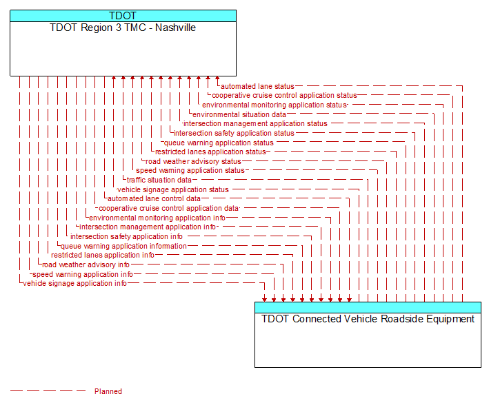
Interface: TDOT Region 3 TMC - Nashville - TDOT Connected Vehicle Roadside Equipment
Information Flow Definitions
automated lane control data (Planned)
Control commands and operating parameters provided to RSEs that control and monitor automated vehicle operations, including tightly coupled platooned groups of vehicles operating in dedicated or mixed–mode lanes. This flow includes platoon parameters including maximum platoon size, target speeds and gaps, and vehicle restrictions.
automated lane status (Planned)
Current operational status of lanes supporting automated vehicle operations. The flow includes the status of the RSEs, associated field equipment, and vehicles using the facility.
cooperative cruise control application data (Planned)
Control commands and operating parameters provided to RSEs that monitor and assist the formation, dissolution, and operation of strings of CACC–equipped vehicles. This flow includes recommended CACC operating parameters including maximum string size, target speeds, gaps, and restrictions. In implementations that support destination–based and optimum performance based formation of strings, this flow also supports regional coordination that assists in the assignment of vehicles to CACC strings.
cooperative cruise control application status (Planned)
Current operational status of the infrastructure enhanced cooperative adaptive cruise control application. The flow includes the status of the RSEs, associated field equipment, and CACC–equipped vehicle strings using the facility.
environmental monitoring application info (Planned)
Environmental monitoring application parameters and thresholds that control the filtering, aggregation, and range of measures that are collected, derived, and reported. This flow also supports remote control of the application so the application can be taken offline, reset, or restarted.
environmental monitoring application status (Planned)
Environmental monitoring application status reported by the RSE. This includes current operational state and status of the RSE and a record of system operation.
environmental situation data (Planned)
Aggregated and filtered vehicle environmental data collected from vehicle safety and convenience systems including measured air temperature, exterior light status, wiper status, sun sensor status, rain sensor status, traction control status, anti–lock brake status, and other collected vehicle system status and sensor information. This information flow represents the aggregated and filtered environmental data sets that are provided by the RSE to the back office center. Depending on the RSE configuration and implementation, the data set may also include environmental sensor station data collected by the RSE.
intersection management application info (Planned)
Intersection and device configuration data, including intersection geometry, and warning parameters and thresholds. This flow also supports remote control of the application so the application can be taken offline, reset, or restarted.
intersection management application status (Planned)
Infrastructure application status reported by the RSE. This includes current operational state and status of the RSE and a log of operations.
intersection safety application info (Planned)
Intersection and device configuration data, including intersection geometry, and warning parameters and thresholds. This flow also supports remote control of the application so the application can be taken offline, reset, or restarted.
intersection safety application status (Planned)
Infrastructure safety application status reported by the RSE. This includes current operational state and status of the RSE and a record of intersection safety issues identified and alerts and warnings issued.
queue warning application information (Planned)
Information regarding formed or impending queues (location of the end of queue, estimated duration of the queue, and other descriptions of the queue condition) and recommendations for upstream vehicles including speed reduction, lane change, or diversion recommendations. This flow also supports remote control of the application so the application can be taken offline, reset, or restarted.
queue warning application status (Planned)
Queue warning application status reported by the RSE. This includes current operational state and status of the RSE and a record of measured vehicle speeds and identified queues.
restricted lanes application info (Planned)
Restricted lane application configuration data and messaging parameters. This flow defines the location, duration, and operating parameters for lanes that are reserved for the exclusive use of certain types of vehicles (e.g., transit vehicles) or vehicles that meet other qualifications (e.g., number of occupants, low emissions criteria). It identifies the lane(s), the start and stop locations, start and end times, vehicle restrictions, speed limits and platooning parameters. This flow also supports remote control of the application so the application can be taken offline, reset, or restarted.
restricted lanes application status (Planned)
Current RSE application status that is monitored by the back office center including the operational state of the RSE, current configuration parameters, and a log of lane use (aggregate profiles of vehicles that checked in to the lane and reported vehicle speeds in the lanes) and RSE communications activity.
road weather advisory info (Planned)
Road weather advisories and associated configuration and control information that are used to manage the RSE. Advisories include segment–specific weather and road conditions including real–time advisories of deteriorating road and weather conditions, medium–term advisories for the next 2–12 hours, and long–term advisories more than 12 hours into the future. This flow includes a schedule for issuing the included advisories.
road weather advisory status (Planned)
Current RSE application status that is monitored by the back office center including the operational state of the RSE, current configuration parameters, and a log of advisories issued. The advisories may include advisories that are issued by the RSE based on locally collected environmental data (e.g., an ice on bridge advisory).
speed warning application info (Planned)
Roadway configuration data, current speed limits including time of day, week, or season speed limits as necessary, and warning parameters and thresholds. This flow also supports remote control of the application so the application can be taken offline, reset, or restarted.
speed warning application status (Planned)
Speed warning application status reported by the RSE. This includes current operational state and status of the RSE and a record of measured vehicle speeds and notifications, alerts, and warnings issued.
traffic situation data (Planned)
Current, aggregate traffic data collected from connected vehicles that can be used to supplement or replace information collected by roadside traffic detectors. It includes raw and/or processed reported vehicle speeds, counts, and other derived measures. Raw and/or filtered vehicle control events may also be included to support incident detection.
vehicle signage application info (Planned)
In–vehicle signing application configuration data and messaging parameters. This flow provides a list of regulatory, warning, and information messages to be displayed and parameters that support scheduling and prioritizing messages to be issued to passing vehicles. This flow also supports remote control of the application so the application can be taken offline, reset, or restarted.
vehicle signage application status (Planned)
In–vehicle signing application status reported by the RSE. This includes current operational state and status of the RSE and a log of messages sent to passing vehicles.